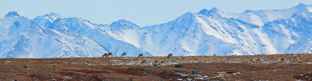
The North Slope of Alaska is a beautiful and rugged place. My current graduate field sites lie in the foothills of the Brooks Range, north of treeline, at the boundary between mountains and tundra. The views of caribou, expansive cottongrass tundra, Pingos, and the like, make a trip to Arctic Alaska well worth it, but I advise travelers to prepare themselves for anything because it is a long way to the nearest popsicle stand.
-
- Transition from the relatively flat and rolling tundra to the mountain landscape of the Brooks Range. Near “Longo’s Pyramid” and the Sagavanirktok River.
-

- Research assistant Pat Tobin found a caribou skull with a complete set of antlers near the Sagavanirktok River.
From 2010-2012, I worked with the Arctic LTER at the Toolik Field Station. The station is about 350 miles north of Fairbanks, AK and 120 miles south of the Arctic Ocean. Three projects I helped with were a) long-term monitoring of lakes for the LTER, b) assessing the impact of thermokarsts on aquatic systems and studying the frequency of thermokarsts in the past, and c) studying the impact of the Anaktuvuk River Fire on lake ecosystems. Here are some pictures from the thermokarst and fire projects.
-
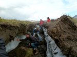
- Researcher assistants check out an exposed ice-wedge near Galbraith Camp. “Thermokarst” describes a topographic slump resulting from the melting of ground-ice.
-
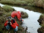
- My very special Alaska and Woods Hole friends, Marjan and Verity, scoping out the stream and thermokarst.
-

- The same ice wedge with overlying soil and roots. The degraded soil and melted ice slumped directly into the stream visible in the background.
-
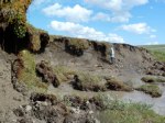
- An active thermokarst front wall just south of TFS. For scale, scientist Dr. Fengsheng Hu in the background is almost 6 feet tall. Notice the “rafts” of vegetation debris. This thermokarst was along the shoreline of a small tundra lake.
-
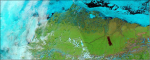
- The dark area is the site of the 2007 Anaktuvuk River Fire as viewed from space by the MODIS satellite. From NASA/GSFC.
-

- This shot, taken 4 years after the fire, shows the boundary between burned and unburned tundra. The cottongrass exploded in the fire-ridden area.
-
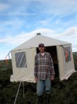
- This was on my first trip to the burned area in 2009. The yurt behind me acted as an emergency shelter for researchers. It would have been a very lumpy, but soft ground to sleep on.
-
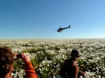
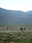
- Toolik researchers watch their ride leave them in an immense plain of cottongrass (Eriophorum vaginatum).
-

- Bird nest lined with down, also along the shore of North Lake. The birds weren’t home.
-

- Buckbean (Menyanthes trifoliata) along the shore of North Lake, which is situated at the north end of the Anaktuvuk fire zone.
